We slept in this morning due to a late breakfast. The extra half hour meant the sun had risen and the tent was nearly dry when I packed it up. As I was coming out of the bathroom, an antlered deer passed by and stopped. I waited for it to wander on. We left Lead, SD by reversing course from the end of yesterday – downhill out of town, then up for a few miles before embarking on today’s adventure.
We started through rolling, pine-forested hills on pristine asphalt. If there is a heaven, it might look like this. The shade was cool, the breeze was light, the sun was warm.
https://www.youtubetrimmer.com/view/?v=ILxo-TUkzOQ&start=0&end=20&loop=0

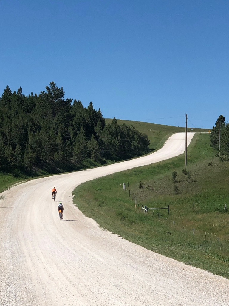
After Moonshine Gulch we came to the “Pavement Ends” sign and embarked on 10 miles of gravel, mostly uphill. The only thing tougher than the long climbs were the descents – a few times my speed exceeded 15 mph. Cars coming the other way raised clouds of dust. A van pulling a trailer approached. I pulled over to give it room. It was labeled “Western Spirit Adventures” and the roof was festooned with mountain bikes. What sort of adventure was this, riding in a van, while we were tackling this on road bikes? Maybe they were headed to a single-track adventure and thought these miles of gravel were just a chore. Or maybe they weren’t so adventurous.

We returned to pavement and crossed a cattle guard at 30 mph – we barely felt it after the miles of gravel. At picnic I kept eating and eating – the morning burned through thousands of calories. We rode into Hill City where I had ice cream and then espresso before leaving the road for the Mickelson Trail. We’d been on quiet back roads but Hill City to Custer was on a US Highway that was one of the low points of 2018 (see that post for details).
Finding the trail was harder than expected – a local 10 year old guided me to it, as it was a sidewalk at the point I intersected it. It soon turned to crushed limestone and was a steady uphill grade for 10 miles. The surface was strongly crowned, so there was a good path for one bike. Meeting another bike took care, as the crown sloped sharply and the gravel was loose on the edges. Occasionally the surface would change to a red gravel which was much squirrelier – like riding in slush. After 10 miles up, the last 5 into town were down. I had planned the route via Google Maps and wanted to double-check the route off of the trail and to the school. My phone was dead. I asked a local, whose directions were wrong and I trusted my gut, which was right. Another rider later told me her phone also died today – aliens? It is plugged in and charging now. The battery had never been this low.
After setting up camp, showering, and hanging laundry, the bike needed cleaning and lubing, as well as checking bolts for tightness. The stem bolts and water bottle cages had rattled loose. My pocket-sized Silca torque wrench is proving to be a valuable addition.
I wondered yesterday about the difference between mountains and hills. A Colorado reader said if it has a tree line, it’s a mountain. If trees go to the top, it’s a hill. By that standard, many of the mountains in California, including the Santa Cruz Mountains, are hills. The Black Hills were named that by white explorers because the heavily-forested hills/mountains looked black in the distance.
Tomorrow we ride the legendary Needles Highway.
